Daud Olatunji
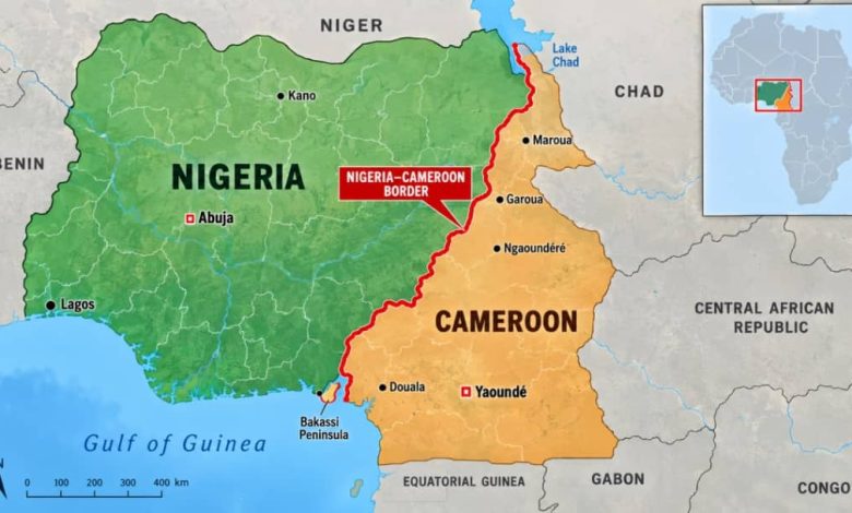
Nearly 24 years after the International Court of Justice ruled on the Nigeria-Cameroon boundary dispute, the physical demarcation of the two countries’ 2,100-kilometre international border is expected to be completed before the end of 2026.
The Director-General of the National Boundary Commission, Adamu Adaji, disclosed this in an interview with the News Agency of Nigeria in Abuja on Sunday.
Adaji said the remaining work was concentrated largely in the Adamawa sector, where more than 260 boundary pillars were being installed to make the internationally recognised boundary visible on the ground.
He said the demarcation could be completed within the next two to three months.
“Hopefully, before the end of the year, we should be done with the demarcation,” Adaji said.
The development comes almost 24 years after the ICJ, sitting at The Hague, Netherlands, delivered its judgment on October 10, 2002, resolving the long-running Nigeria-Cameroon land and maritime boundary dispute and awarding sovereignty over the Bakassi Peninsula to Cameroon.
Following the judgment, Nigeria and Cameroon, under United Nations auspices, established the Nigeria-Cameroon Mixed Commission to implement the court’s decision and resolve outstanding issues along the boundary.
According to Adaji, the process initially faced difficulties in some areas because the boundary lines created challenges for communities whose historical, cultural and demographic identities did not correspond neatly with the court-defined boundary.
He said the disagreements had since been resolved through interventions by the governments of both countries, with adjustments and concessions made to protect affected communities and prevent the boundary from splitting predominantly Nigerian or Cameroonian settlements.
“One of the things we had to do was to consider the interests of the people living along the boundary.
“For example, a boundary line should not place a settlement that is predominantly recognised as Nigerian on the Cameroonian side while placing a settlement recognised as Cameroonian on the Nigerian side,” he explained.
Adaji cited Koja as one of the communities significantly affected by the original boundary alignment.
According to him, about 90 per cent of Koja was initially placed on the Cameroonian side under the ICJ-defined boundary, but negotiations between the two countries resulted in the entire community being retained in Nigeria.
He said concessions were made elsewhere, citing Turu, where the population was predominantly Cameroonian.
“While an area such as Koja, where Nigerians are predominant, was retained in Nigeria, an area such as Turu, where Cameroonians are predominant, was treated as a concession to Cameroon.
“That is what was done. It is not simply about defining a boundary; it is also about taking the interests of affected communities into account,” the NBC boss said.
He said such arrangements were necessary to promote lasting peace and cooperation between the two neighbouring countries.
The Nigeria-Cameroon boundary, according to Adaji, is Nigeria’s longest international land boundary, stretching approximately 2,100 kilometres from the Chad Basin through the states bordering Cameroon to the Atlantic coast.
He said Nigeria shares approximately 770 kilometres of land boundary with Benin Republic and 1,500 kilometres with Niger Republic.